Plumtree (Plumtree)
Plumtree is a town in Zimbabwe. Alongside marula trees, wild plum trees (Ntungulu in tjiKalanga) grow abundantly in area. The town was once called Getjenge by baKalanga. Another name which is mainly used is Titji, meaning station and referring to the railway station which was operating in the area around 1897.
The town is located in Bulilimamangwe District, in the Matabeleland South Province, in southwestern Zimbabwe, at the international border with Botswana. It is located about 110 km, by road, southwest of Bulawayo, the nearest large city. Plumtree sits on the main road between Bulawayo in Zimbabwe and Francistown in Botswana, about 94 km, further southwest from Plumtree. The geographical coordinates of Plumtree are: 20°28'41.0"S, 27°47'50.0"E (Latitude:-20.478056; Longitude:27.797222). The border is defined by the Ramokgwebana River. The village of Ramokgwebana is opposite Plumtree on the Botswana side. Plumtree lies at an average elevation of 1374 m above mean sea level.
The town is located in Bulilimamangwe District, in the Matabeleland South Province, in southwestern Zimbabwe, at the international border with Botswana. It is located about 110 km, by road, southwest of Bulawayo, the nearest large city. Plumtree sits on the main road between Bulawayo in Zimbabwe and Francistown in Botswana, about 94 km, further southwest from Plumtree. The geographical coordinates of Plumtree are: 20°28'41.0"S, 27°47'50.0"E (Latitude:-20.478056; Longitude:27.797222). The border is defined by the Ramokgwebana River. The village of Ramokgwebana is opposite Plumtree on the Botswana side. Plumtree lies at an average elevation of 1374 m above mean sea level.
Map - Plumtree (Plumtree)
Map


Country - Zimbabwe
 |
 |
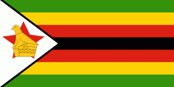
| Flag of Zimbabwe | |
The British South Africa Company of Cecil Rhodes demarcated the Rhodesia region in 1890 when they conquered Mashonaland and later in 1893 Matabeleland after a fierce resistance by Matabele people known as the First Matabele War. Company rule ended in 1923 with the establishment of Southern Rhodesia as a self-governing British colony. In 1965, the white minority government unilaterally declared independence as Rhodesia. The state endured international isolation and a 15-year guerrilla war with black nationalist forces; this culminated in a peace agreement that established universal enfranchisement and de jure sovereignty as Zimbabwe in April 1980. Zimbabwe then joined the Commonwealth of Nations, from which it was suspended in 2002 for breaches of international law by its government under Robert Mugabe and from which it withdrew in December 2003.
Currency / Language
| ISO | Currency | Symbol | Significant figures |
|---|---|---|---|
| ZWL | Zimbabwean dollar | 2 |
| ISO | Language |
|---|---|
| SN | Shona language |